 HOME PAGE
-
HOME PAGEwelcome to our site
 ABOUT US
-
ABOUT USwho we are
 SERVICES
-
SERVICESbest services
 PRODUCTS
-
PRODUCTSsatellite imagery
 GALLERY
-
GALLERYimage gallery
 CONTACTS
-
CONTACTScontact information
Welcome to our site!
 MIR GeoSpatial offers innovative, strategic, results-oriented geospatial services and consultancy. MIR GeoSpatial has specialized in performing services in geomatics and image processing, digital photogrammetry, geographic information systems and remote sensing for private and public sector clients.
We partner with our clients to turn our combined knowledge and insights into strategies and solutions; the implementation of which, will have substantial, positive and immediate results.
What We Offer
Experienced staff of MIR GeoSpatial provides advanced services integrate various technologies, including remote sensing, GIS, GPS, CAD components and satellite imagery for creation of high resolution digital elevation/terrain models; creation of high resolution digital orthoimagery to support engineering and cadastral applications for survey planning, highway-railroad-pipeline routing, facilities monitoring. read more
Experienced staff of MIR GeoSpatial provides advanced services integrate various technologies, including remote sensing, GIS, GPS, CAD components and satellite imagery for creation of high resolution digital elevation/terrain models; creation of high resolution digital orthoimagery to support engineering and cadastral applications for survey planning, highway-railroad-pipeline routing, facilities monitoring, or any application that requires high accuracy terrain-corrected imagery; image processing for change detection, image classification, spatial modelling and visualisation; topological data structuring to support utility and municipal applications for public works, development, infrastructure planning, design, implement and management their projects and consulting and training in operating procedures with respect to image processing.
Our Mision
 To assist organizations,
in gaining a lasting geospatial strategic advantage through a combination of innovative planning and dedicated...
To assist organizations,
in gaining a lasting geospatial strategic advantage through a combination of innovative planning and dedicated...read more
To assist organizations in gaining a lasting geospatial strategic advantage through a combination of innovative planning and dedicated execution - enabling our clients to meet todays challenges and exceed tomorrows goals.
MIR GeoSpatial also plans to build long term relationships with people through honesty and integrity with the most efficient service of which the company is capable, rendering the fullest possible quantity and the best possible quality of service in the capacity of the geospatial industry.
MIR GeoSpatial also plans to build long term relationships with people through honesty and integrity with the most efficient service of which the company is capable, rendering the fullest possible quantity and the best possible quality of service in the capacity of the geospatial industry.
Our Advantages
Government and commercial organizations have made significant investments in geospatial technology.
Organizations have, in many cases, dedicated considerable capital resources for specialized software, extensive data collections, and on-site analyst support; without realizing the full return on investment. Some organizations have struggled to create standards and procedures and have not fully utilized their investment to disseminate geospatial capability throughout the organization. The implementation of geospatial technology in an organization is designed to improve critical decision making capability, increase accessibility and reliability of data and control costs through the centralization of geospatial assets. We helps organizations manage and gain the true value of their business content and at MIR GeoSpatial, we measure our success on the impact we have within our clients organization.
A Few Word About Us
MIR GeoSpatial is an emerging, privately-owned technology and consulting firm that specializes in providing services to support the successful implementation, integration, and promotion of geospatial technology within organizations. We are committed to ensuring our clients maximize their geospatial capability by providing professionals with proven geospatial technological and planning experience.MIR GeoSpatial has become business partner of VRICON, www.vricon.com , to serve high resolution 3D products for commercial and government customers. Our product portfolio now includes high-accuracy 3D data and 3D visualization solutions for decision makers without requiring ground control points. read more
VRICON combines Saab's unique 3D technology and know-how with DigitalGlobe's unrivaled archive which contains millions of square kilometers of the world's highest quality commercial satellite imagery. Vricon's high scale production capabilities create highly accurate photorealistic 3D products and elevation data of the earth, accessible via a unique visualization platform and standard based data formats.
Partners

List of Services
Digital Image Processing :
Digital Image Processing is one of our core technology offerings. Specializing in services that design and develop special purpose image processing algorithms, thus improving quality and enhancing the utilization of imagery for a wide range of clients. MIR GeoSpatial also offer innovative techniques and processes to obtain needed information from imagery as well as the development and integration of image processing algorithms with software into a user's work environment.
With the integration of various GIS, RS and CAD technologies, MIR GeoSpatial provides premium image processing services, including
Orthorectification (high accuracy terrain corrected imagery)
Second Generation Ortorectification
Image Change Detection (monitoring and quantifying changes over time, using temporal sequence of imagery over large regions, along pipeline/transmission corridors or within cities)
Mosaicking and Radiometric Balancing
Terrain Rectification
2D and 3D Visualization
Supervised and Unsupervised Classifications
Image Feature Extraction (human-made feature extraction; facilities, transportation features, land-use/land-cover, vegetation types)
Additional image processing services:
Image Fusion (pan-sharpening)
Band Manipulation (tilling, clipping, subsetting, 8 bit/16 bit conversion)
Data Conversion (GeoTIFF to NITF, IMG, JPEG)
Compression (MRSID, ECW)
Reprojection (WGS84 to ED50, ITRF and UTM to TM)
Value Added Services : For the experienced user, we provide our most flexible Image Processing Products; as Topographic Analysis, Site Model Production, Mozaicking, Classification, Map Sheeting; and Vector Data Generation; as Building Layer Generation, Road Layer Generation, Land Use/Land Cover Generation, Land Use Map Digitization and more.
3D Products and Digital Elevation Models: In addition to our production capability of digital elevation models using traditional stereo pairs, we also provide VRICON's digital surface models and digital terrain models with an immersive global coverage acquired by using extensive VHR satellite imagery archive. 3D data sets have photorealistic texture as a result of Vricon's 3D processing technology. It is an automated stereoscopic reconstruction process and can satisfy unprecented accuracy without any ground control points.
Topographic and Photographic Mapping : Most national maps are old, outdated, and largely exist in analogue form. Due to the high cost of aerial photography, these maps have not been updated for many years and as such are not useful for planning and navigation purposes. Therefore, there is an urgent need to produce new maps or update existing ones. MIR GeoSpatial has a wide experience in rapid and cost-effective updating of topographic and planimetric maps using high resolution satellite data. The method entails undertaking preliminary interpretation of georeferenced satellite imagery based on predefined classification and aided by secondary ancillary data; identification of sample points that prompt GPS facilitated ground truthing; conducting the final image interpretation. MIR GeoSpatial employs the latest in digital photogrammetric mapping tools to process high-resolution satellite imagery data and deliver precise mapping products. From managing the supplement of imagery, through aerial triangulation and stereo compilation, to the production of digital terrain models and orthophotographs.
MIR GeoSpatial offer public or private sector organizations to implement and complete topographic mapping projects in support of planning, engineering and design stages. We produce assistance of computer technology to makes it easier to produce new maps easily and revise the existing ones. Improved and effective processes have replaced the old ways of compiling information to deliver new maps with the help of integration various technologies of digital mapping from different sources composed of satellite images and GPS field data. World wide acceptance of computer produced maps has accelerated the use of computer compatibility of topographic mapping services. Mapping capabilities of MIR GeoSpatial serve a wide range of disaster management, engineering and architecture activities, defense and security, infrastructural services, route planning, geographical representation of thematic data, telecommunication, oil and gas and transportation services, etc.
High resolution satelite imagery has become crucial to the production and accurate updating of medium to large scale topographic maps. By the help of sofisticated GIS tools, we offer mapping products include topographic contours, planimetric and cultural mapping, high resolution orthoimagery for base mapping and image classification, DEM, DTM and triangulated irregular network (TINS).
Utility Mapping : We aim to offer our clients outstanding Automated Mapping / Facilities Management Systems (AM/FM) and Geographic Information Systems (GIS) for all areas of water mains, sewage systems, telecommunicaitons, gas & electric transmission/distribution.
Generation and delivery of utility mapping system is vital for organizations to meet all needs in terms of regional and national planning, infrastructure management, land administration and cadastre, urban development, emergency response, safety and security issues.
Often the geographic location is recorded on inferior quality maps and in some cases it is not documented at all. The true power of GIS utility mapping is revealed when it is combined with the geographic location of the facility and revenue information, coming from where it is. Our advanced services integrate various technologies of digital mapping from different sources composed of satellite images, GPS field data and existing maps. MIR GeoSpatial can work with you to assure that your GIS/digital utility mapping system is a key input in:
Easy and quick access to the information consisting of location and attribute data
Simple comparison of data about different types of utility lines, topography and base maps
Integration with register data and consumer information
Efficient updating
Flexible extraction and analysis options
Spatial Data Integration : MIR GeoSpatial assits customers to integrate their spatial data into information systems or other systems/data bases and end-user tools.
Geospatial Data Processing Services
 MIR GeoSpatial offers;
application, integration and development of geospatial data systems and technological solutions. MIR GeoSpatial offers a full-range services including value-added products;
read more
MIR GeoSpatial offers;
application, integration and development of geospatial data systems and technological solutions. MIR GeoSpatial offers a full-range services including value-added products;
read more
MIR GeoSpatial offers application, integration and development of geospatial data systems and technological solutions. MIR GeoSpatial offers a full-range services including value-added products;
Orthoimagery production
Digital Elevation/Terrain Models Creation
Digital orthophoto and topographic mapping
Stereopair processing, 3D feature extraction and mapping
Digital map revision
Vector alignment/conflation
Supervised & unsupervised classifications
Land-use and Land-cover mapping
Land base updating
Feature extraction services, i.e. buildings, roads, hydrology,
Change detection
Data re-projection, conversion and compression
Image compression services
Third party audits of mapping and image data
Mosaicking and Radiometric balancing
Visual services
Geospatial Analysis & Consulting Services
MIR GeoSpatial offers; innovative, strategic, results-oriented geospatial data solutions and consultancy services for maximizing organizations geospatial capability in to local governments, oil & gas, utilities, transportation, agriculture, communications industries. We provide organizational assistance with geospatial requirements definition, application development and overall geospatial enterprise integration.read more
MIR GeoSpatial offers innovative, strategic, results-oriented geospatial data solutions and consultancy services for maximizing organizations geospatial capability in to local governments, oil & gas, utilities, transportation, agriculture, communications industries. We provide organizational assistance with geospatial requirements definition, application development and overall geospatial enterprise integration.
In order to provide economic solutions tailored to client requirements, MIR GeoSpatial supports its customers through detailed consultancy in user needs assessment, project planning and implementation, data acquisition, data processing and integration and implementation of geospatial products and data procesing services.
We have comprehensive experience in defining requirements and structuring solutions that make the most of technology investments, improve business process management capabilities from both an enterprise and a departmental perspective.
MIR GeoSpatial provides on-site, customized geospatial training services to end users and administrators on request.
MIR GeoSpatial with more than a decade of experienced staff provides independent strategic and tactical geospatial consulting services to their customers. MIR GeoSpatial assists clients with comprehensive enterprise solutions relating to;
Strategic planning, design, development, and deployment of spatial database systems as well as custom application development
Project management, needs assessment & strategy
Interagency coordination and data integration
On-site support and user training
High Resolution Satellite Images
 High Resolution Imagery Overview
MIR GeoSpatial is solely focused on fulfilling the high resolution satellite imagery needs of our customers. MIR GeoSpatial has established preferred relationships...
read more
High Resolution Imagery Overview
MIR GeoSpatial is solely focused on fulfilling the high resolution satellite imagery needs of our customers. MIR GeoSpatial has established preferred relationships...
read more
MIR GeoSpatial is solely focused on fulfilling the high resolution satellite imagery needs of our customers. MIR GeoSpatial has established preferred relationships with the leading commercial satellite data providers regional partners and can thus select the best and most cost effective source(s) to meet your particular application.
Below is a brief summary of each range of imagery products;
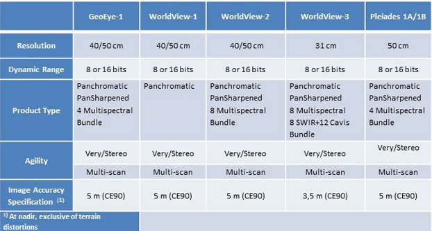
Commercial Very High Resolution Satellite Imagery Comparison Chart
Additional Information & Pricing:
For additional information and pricing, please contact us at +90 312 4376650 or info@mirgeospatial.com
Commercial Very High Resolution Satellite Imagery Comparison Chart
Additional Information & Pricing:
For additional information and pricing, please contact us at +90 312 4376650 or info@mirgeospatial.com
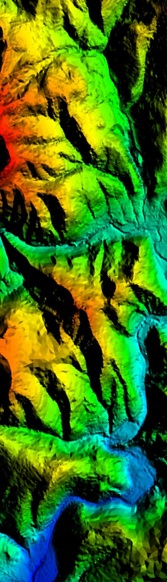
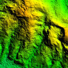
Digital Terrain and Surface Model
 VRICON 3D PRODUCT SUITE
By offering photorealistic perspective and high accuracy, VRICON's 3D product suite provides an ideal solution for defense&security, topographic mapping/surveying, disaster management...
read more
VRICON 3D PRODUCT SUITE
By offering photorealistic perspective and high accuracy, VRICON's 3D product suite provides an ideal solution for defense&security, topographic mapping/surveying, disaster management...
read more
By offering photorealistic perspective and high accuracy, VRICON's 3D product suite provides an ideal solution for defense&security, topographic mapping/surveying, disaster management, infrastructure planning and routing, telecom antenna placement and urban monitoring.
VRICON 3D Surface Model - 0.5 meter Resolution Photorealistic 3D Surface Model
VRICON DSM - 0.5 meter Resolution Digital Surface Model
VRICON DSM10 - 10 meter Medium Resolution Digital Surface Model
VRICON DTM - 0.5 meter Resolution Digital Terrain Model
VRICON Point Cloud - Full Color 3D Point Cloud
VRICON TRUE ORTHO - 0.5 meter Resolution Ortorectified Image
For more product details, please contact us at info@mirgeospatial.com.
STEREO IMAGE PAIR - DEM GENERATION
Earth observation satellite imagery has become crutial to production and accurate updating of earths surface that includes all objects on it as, man-made features, vegetation, etc, and of earths bare ground surface without any objects on it.
VRICON 3D Surface Model - 0.5 meter Resolution Photorealistic 3D Surface Model
- Post spacing: 50 cm
- Textures: True photorealistic textures on all sides of buildings and terrain features
- Absolute Accuracy: 3 meter LE90, 3 meter CE90
- Relative Accuracy: 1 meter LE90, 2 meter CE90
- Valid on all surfaces and terrain types
- Valid without using ground control points
VRICON DSM - 0.5 meter Resolution Digital Surface Model
- Post spacing: 50 cm
- File format: GeoTIFF
- Bit depth: 32-bit
- Absolute Accuracy: 3 meter LE90, 3 meter CE90
- Relative Accuracy: 1 meter LE90, 2 meter CE90
- Valid on all surfaces and terrain types
- Valid without using ground control points
VRICON DSM10 - 10 meter Medium Resolution Digital Surface Model
- Post spacing: 10 meter
- File format: GeoTIFF
- Bit depth: 32-bit
- Absolute Accuracy: 3 meter LE90, 3 meter CE90
- Relative Accuracy: 1 meter LE90, 2 meter CE90
- Valid on all surfaces and terrain types
- Valid without using ground control points
VRICON DTM - 0.5 meter Resolution Digital Terrain Model
- Post spacing: 50 cm
- File format: GeoTIFF
- Bit depth: 32-bit
- Absolute Accuracy: 3 meter LE90, 3 meter CE90
- Relative Accuracy: 1 meter LE90, 2 meter CE90
- Valid on all surfaces and terrain types
- Valid without using ground control points
VRICON Point Cloud - Full Color 3D Point Cloud
- Point spacing: 50 cm
- Point Density: 4 ppm
- Projection: Compliant with common reference systems
- Datum: WGS84
- Point attributes: True RGB spectral returns for each point
- Absolute Accuracy: 3 meter LE90, 3 meter CE90
- Relative Accuracy: 1 meter LE90, 2 meter CE90
- Valid on all surfaces and terrain types
- Valid without using ground control points
- Data format: LAS 1.2 (RGB colorized)
VRICON TRUE ORTHO - 0.5 meter Resolution Ortorectified Image
- Resolution: 50 cm
- File format: GeoTIFF
- Bit depth: 8-bit RGB
- Provides parallax-free and occlusion-free imagery
- Projection: Compliant with common reference systems
- Datum: WGS84
- Absolute Accuracy: 3 meter CE90
- Relative Accuracy: 2 meter CE90
- Valid on all surfaces and terrain types
- Valid without using ground control points
For more product details, please contact us at info@mirgeospatial.com.
STEREO IMAGE PAIR - DEM GENERATION
Earth observation satellite imagery has become crutial to production and accurate updating of earths surface that includes all objects on it as, man-made features, vegetation, etc, and of earths bare ground surface without any objects on it.
Satellite Imagery Products
1. Mono Satellite Imagery
Standard mono imagery is at least processed image product. This level of product is corrected only for radiometric distortions and adjusted for internal sensor geometry, optical and sensor distortions and well suited for visual analysis, image classification, as a backdrop for GIS and mapping applications that require a modest level of accuracy and as the basis for doing your own orthorectification. This level imagery product is shipped with the sensor camera model in rational polynomial coefficient (RPC) format. This camera model maps the respective ground coordinates to image product coordinates. Block adjustment, orthorectification, and other photogrammetric processing can be performed with the RPC camera model.
2. Stereo Satellite Imagery Stereo Pair Imagery products are designed for users with advanced image processing capabilities and Photogrammetric tools. This product is ideal for Digital Elevation/ Terrain Model (DEM/DTM) generation, 3D visualization, feature extraction and more accurate mapping applications. Stereo imagery products are collected on the same orbit, and are acquired at angles optimal for stereo viewing and manipulation.
3. Orthorectified Imagery When you need the highest possible accuracy and a ready-to-use product, our orthorectified imagery products are the solution.
4. General Specifications File Formats: GeoTIFF, NITF 2.1, NITF 2.0
Mosaic: Yes if applicable
Dynamic Range Adjustment: On
Color Balancing: Optional for mosaics
Projections & Datums: UTM / WGS84 or Any supported datums and projection
Customer Framing: Area-based, with a minimum purchase of 100 sq.km for new collection, 25 sq.km. for archive imagery
Delivery Media: Products are delivered on your choice of standard digital media with Image Support Data files including image metadata.
Cloud Coverage: Standart, less than 15%
Airbus Defence & Space

DigitalGlobe

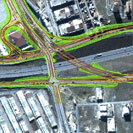
Sample Imagery List
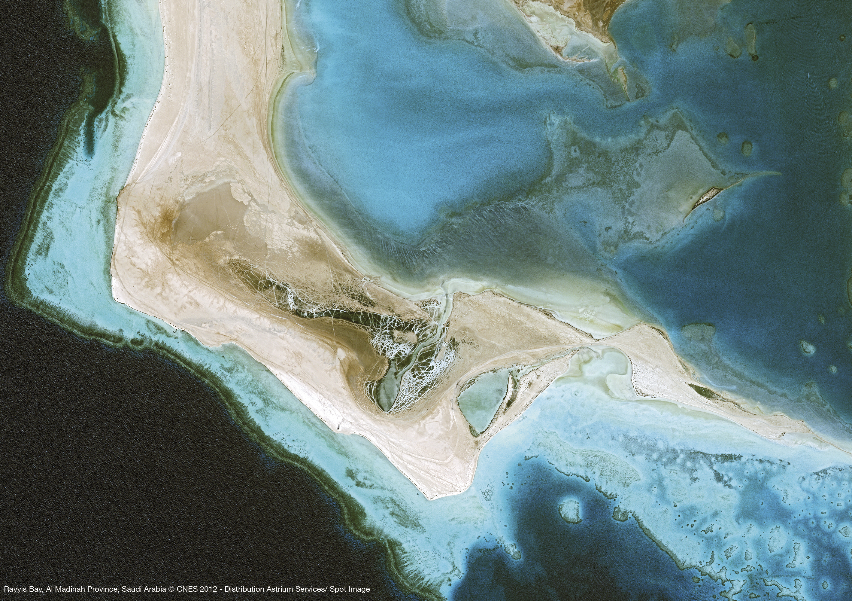
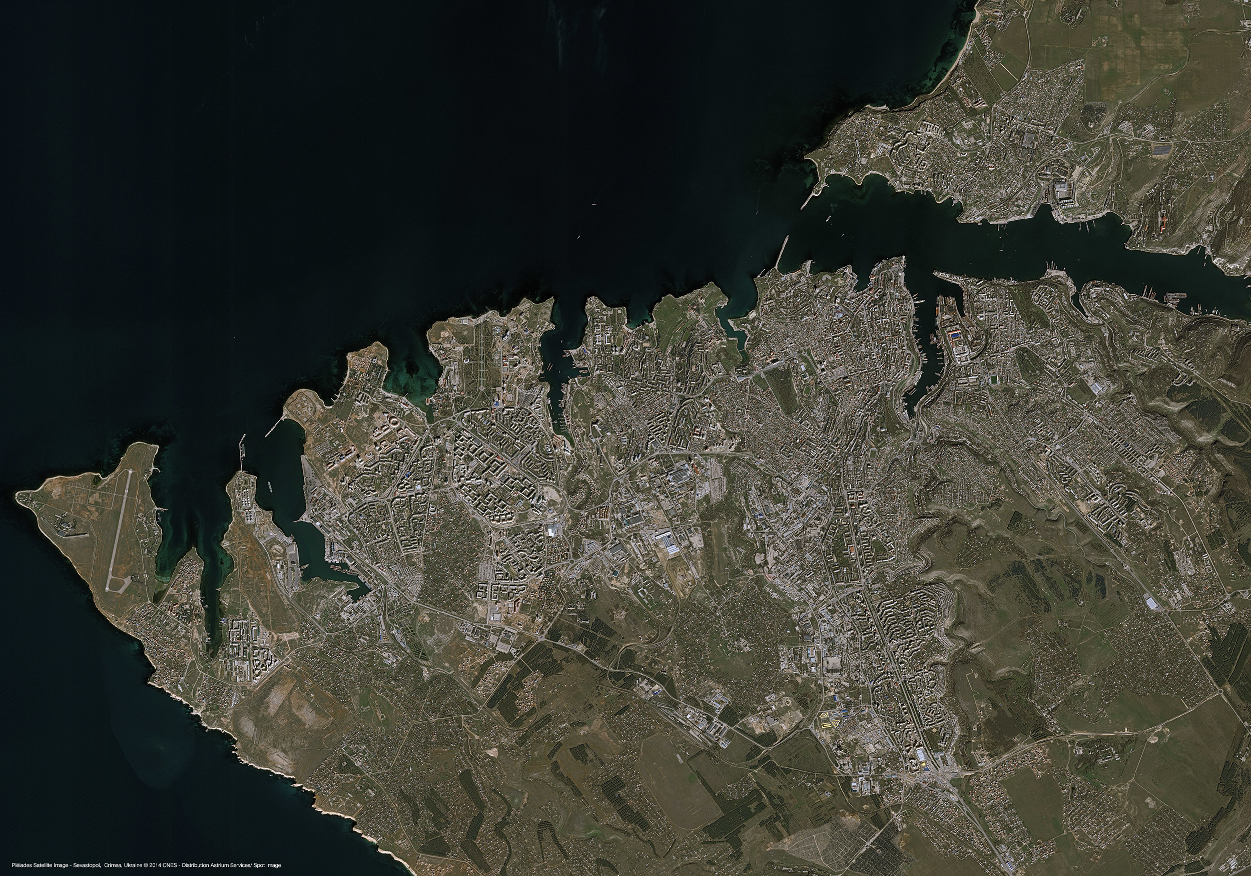
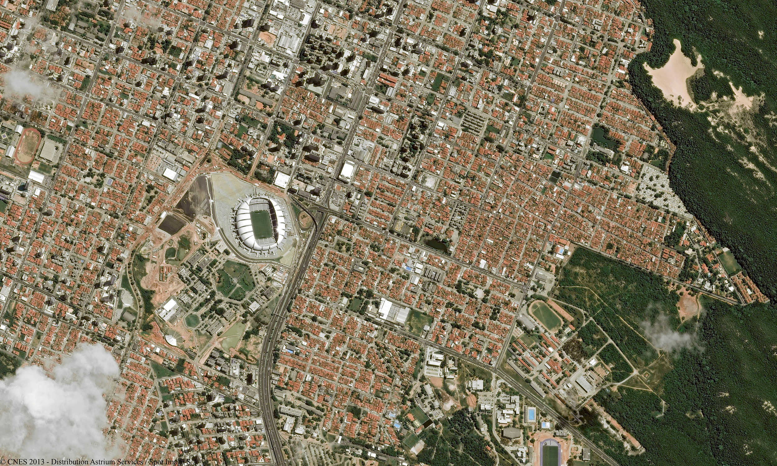
Satellite image courtesy of Airbus Defence & Space1)Rayyis Bay, Saudi Arabia
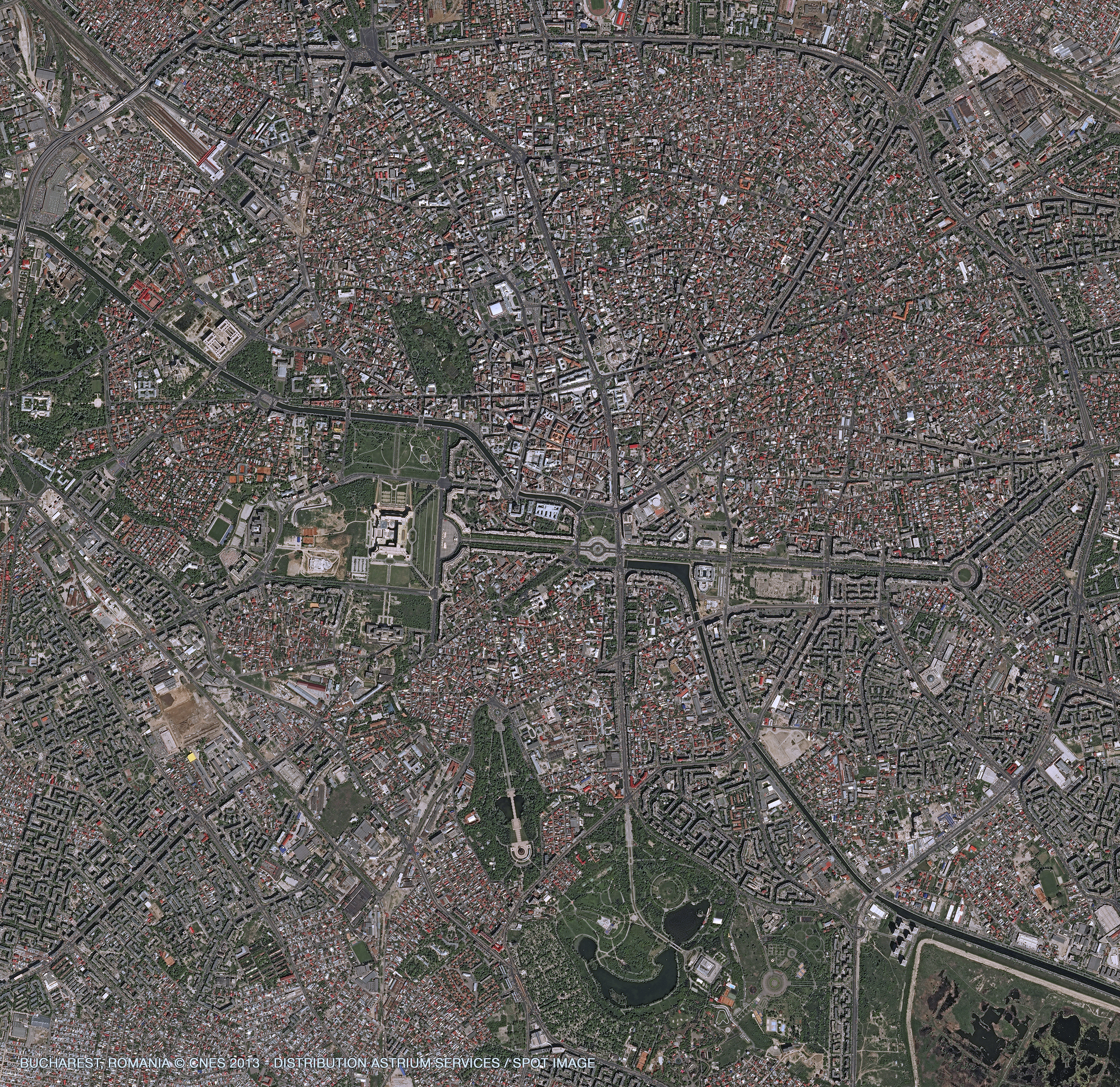
2)Bucharest, Romania
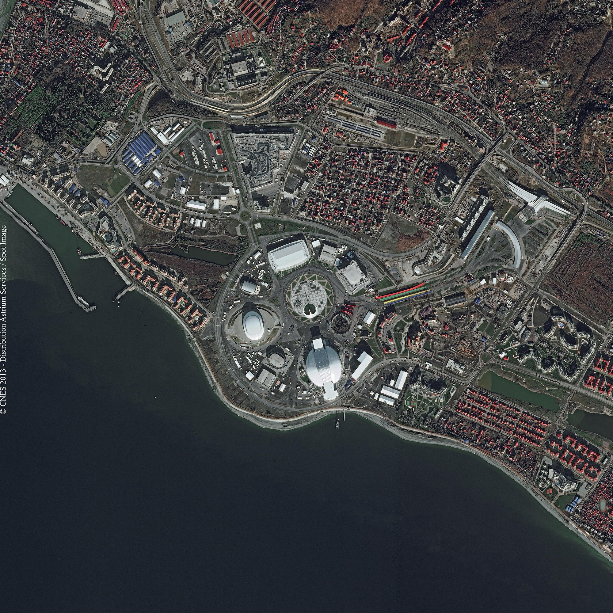
3)Sochi, Russia
4)Sevastopal, Ukraine
5)Rio Grande do Norte, Brazil
6)Castillon Dam, France
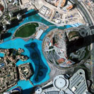
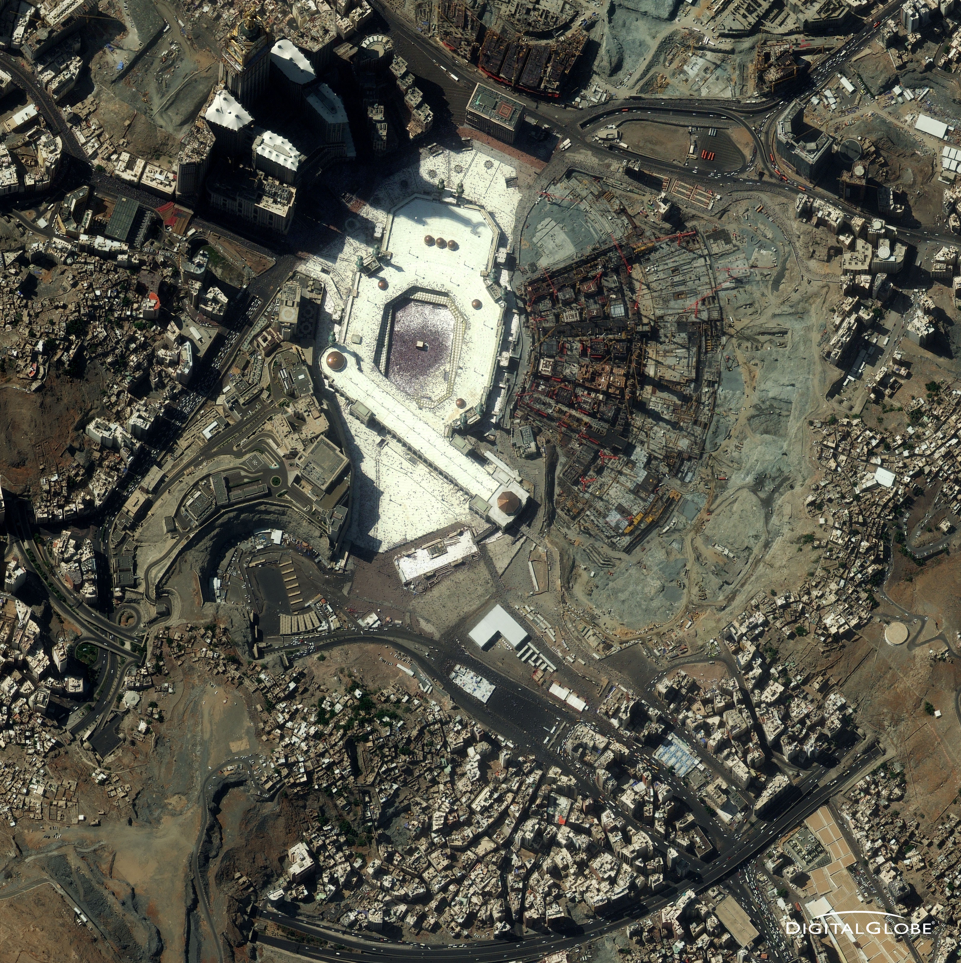
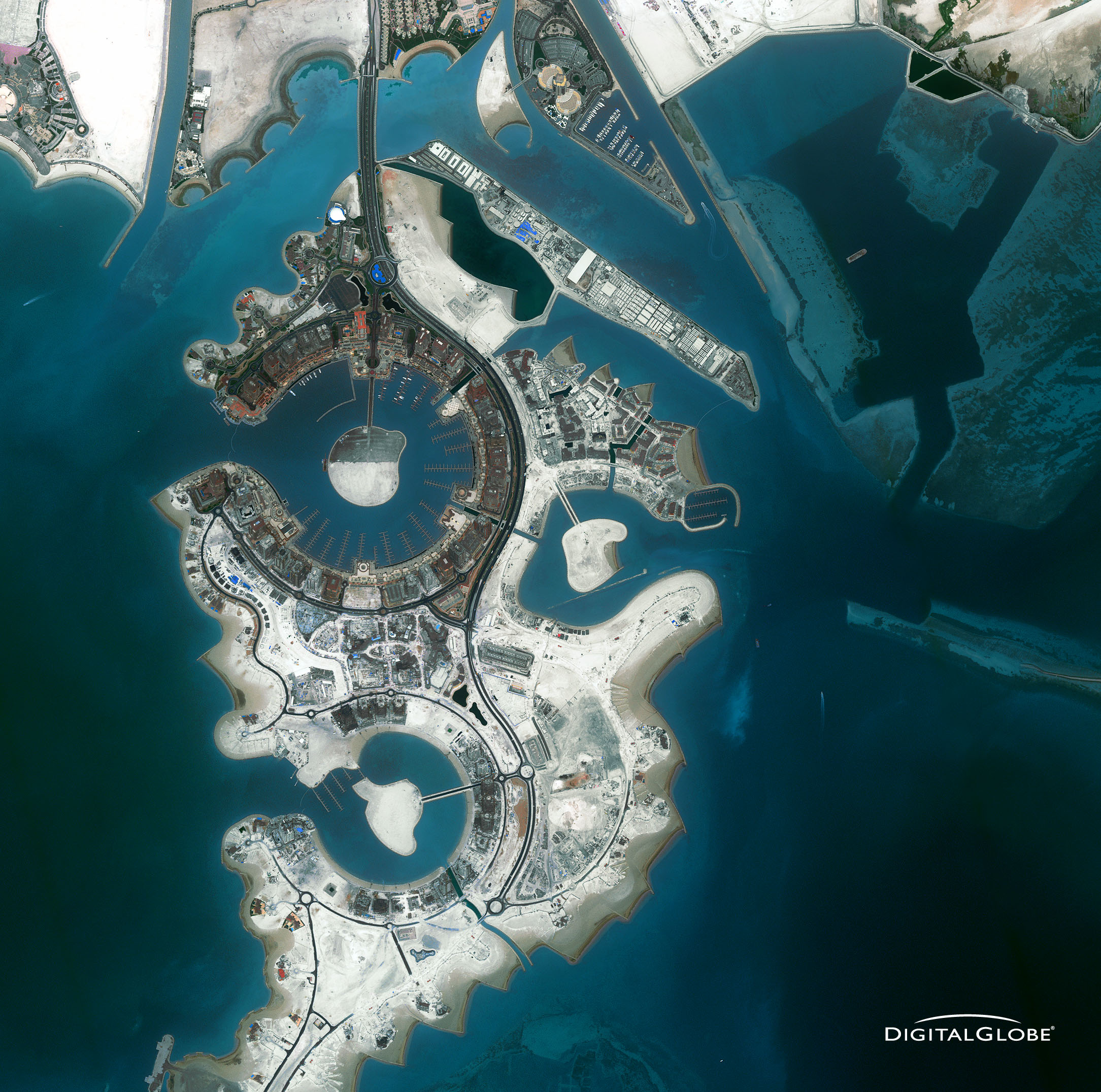
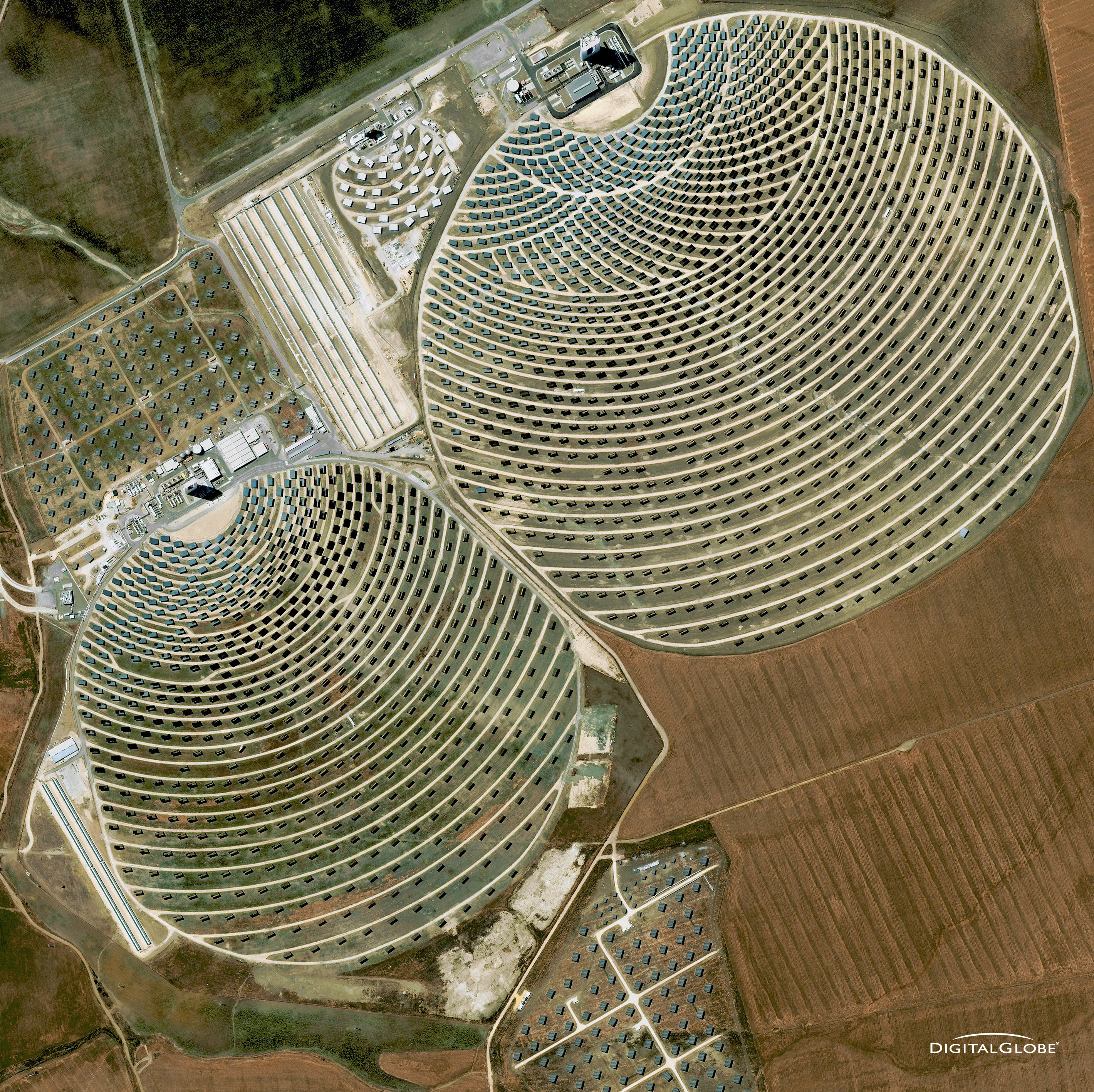
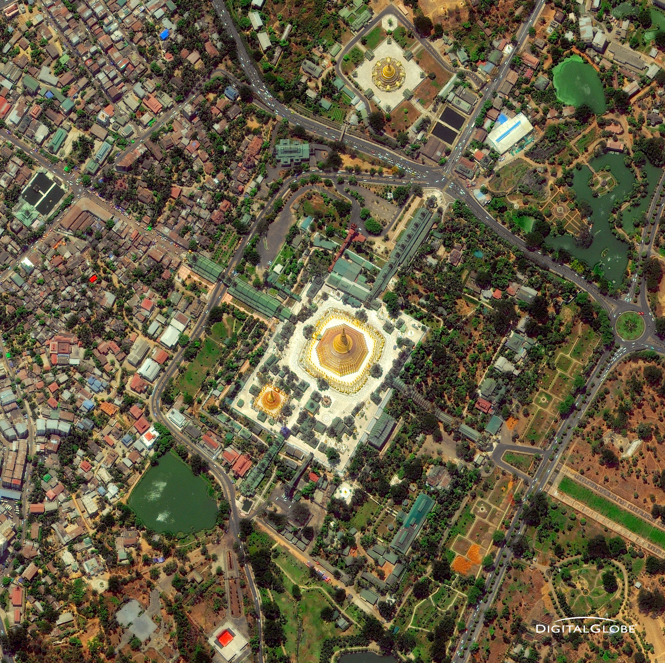
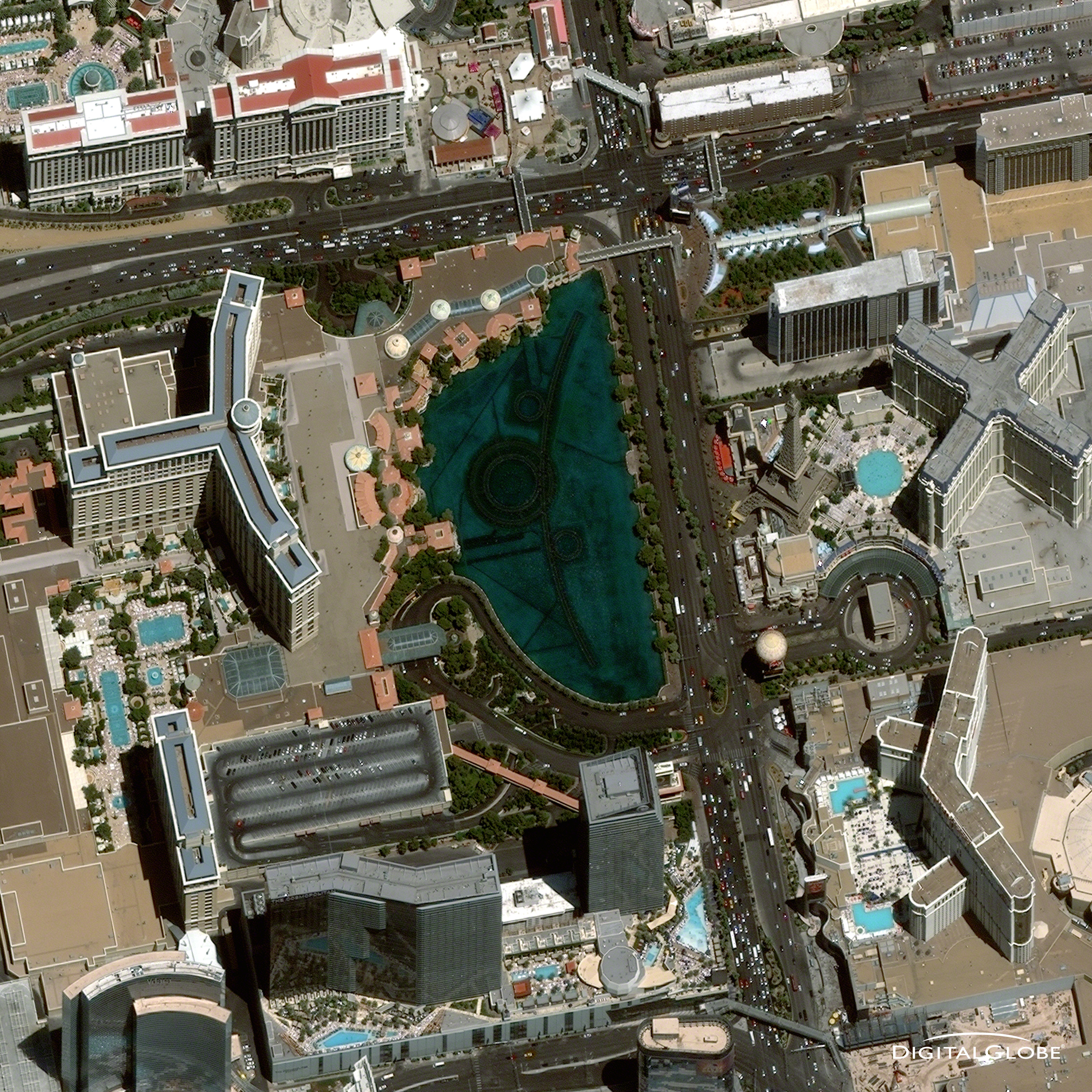
Satellite image courtesy of DigitalGlobe
1)Mecca, Saudi Arabia
2)Doha, Qatar
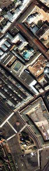
3)Seville, Spain
4)Rangoon, Burma
5)San Francisco, California, USA
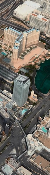
6)Las Vegas, Nevada, USA
Contact Address
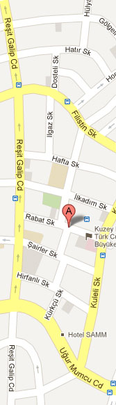
 MIR GeoSpatial Technology Solutions Eng. & Foreign Trade LLC
Rabat Sk. 7/5, 06700
MIR GeoSpatial Technology Solutions Eng. & Foreign Trade LLC
Rabat Sk. 7/5, 06700GOP, Ankara, Turkey
Telephone: +90 312 4376650
Fax: +90 312 4376651
Email: info@mirgeospatial.com
Useful Links
www.digitalglobe.com
Satellite imagery and geospatial information products
www.vricon.com
3D geodata and 3D visualization solutions
www.intelligence-airbusds.com
Satellite imagery and geospatial solutions
Satellite imagery and geospatial information products
www.vricon.com
3D geodata and 3D visualization solutions
www.intelligence-airbusds.com
Satellite imagery and geospatial solutions